Sunday, September 29, 2013

The Giants 28 Sept 20013

 One of the first impressions you get when you drive down the Avenue of the Giants is how much light is intercepted by the huge crowns.  It was an extremely bright and sunshiny day, but only a few flecks of light made it to the ground.
 Next to our RV park was this big specimen known as "The Eternal Tree".  For many of these trees, this is not a misleading name.  Often, when large trees fall, they are replaced by smaller trees that sprout from the roots of their forerunner.  One could consider this as truly immortal protoplasm. This tree is approximately 950 years old, and has survived numerous disasters.  Repeated lightening strikes have removed nearly 50 feet of its once nearly 400 foot height.  The axe on the side marks the high water mark of the 1964 flood.  These trees are in the flood plain of the nearby Eel River.
The area between Ted's fingers mark over 100 years of growth.  This was one of the smaller logs in the area. 
 The hole left when this tree fell was at least 10 feet deep, even though there has obviously been a great deal of soil washed into it.
 This was one of the taller trees in the nearby Rockefeller Grove.  It is at least 120 feet to the first branch.
 Even the galls are impressive.  This one is, at least, four feet wide at its widest point and around 8 feet from top to bottom.
 It is impossible to give a true appreciation for the size of these marvelous organisms.  Ted's five foot ten inch height seems almost out of place here.
This snag and the red cast of the dead foliage lends a cathedral-like feeling to this forest.  When you hear people speak, it is always in hushed tones. This only adds to the worshipful ambiance.
 How long did this tree live before it fell?  How long ago was that?  Time seems immaterial.
We have both read Fall of the Giants, and, although it has nothing to do with the redwoods, somehow, that title seems to fit here.  The smallest of these logs was at least seven feet in diameter.  Perhaps this was a chain reaction in which one tree fell into others causing them to fall.  They were cut only to make a path through them.  Superlatives seem woefully inadequate.
 This little fellow seems to predict a long winter as he crawls between the red feather-like redwood foliage.  The passage of seasons matters more here than the passage of years.
As we were walking through the woods, we met an attractive young couple walking on the same path.   They were kind enough to allow us to take a photograph of their cute baby, who seemed perfectly content sitting in the lap of this giant.  There is only an age difference of  a millennium or two. 
 This gives some perspective, doesn't it? 
By the way, thank you again for letting us put your baby on our blog and especially for your service HOOAH!! 

Scotia and Eureka 27 Sept 2013

 We journeyed into town to pick up a few groceries.  On our way, we passed the small town of Scotia.  It's easy to see what powers the economy here.  In this photo, stickered, drying lumber is in the foreground and sustainably harvested redwood logs are in the background.  Down the road a bit is a redwood planer mill that converts these rough-sawn pieces of lumber into finished product for shipment to your local lumber yard.  Despite the popular concept, the Coast Redwood is one of the fastest growing trees in North America.
 Scotia was, for most of its existence, a company town.  All of the houses on this block are, except for color, exactly identical.  They are occupied by employees or retirees of the sawmill. 
The Scotia Inn has hosted guests since 1888.  It burned in the early 1900s and was replaced in 1923.
The electricity for the mill and the town are generated in this biomass plant.  Bet you can guess what powers it.  Yep, sawdust and combustible waste from the sawmill, although some agricultural waste is accepted.  It was, until 2003 also owned by the sawmill.  As a part of a chapter 11 reorganization, it along with some houses and businesses, sold by the company.
 Scotia is justifiably proud of its logging heritage.  Unfortunately, this logging museum was closed.  Note the columns made from perfectly sized redwood logs.
 Outside the museum, this big triple-spool steam donkey was, no doubt, the power behind a high lead yarder.  The gear-drive Heisler locomotive is equipped with wheels that were designed to run over a track constructed of small logs rather than steel rails.  Logs were hauled to a landing from which they could be loaded onto a larger train running on steel rails for transport to the sawmill.
This small single-spool steam-donkey was likely used to pull logs along the ground by means of long ropes or steel cables.
A few miles further north, Eureka was for years also powered by lumber, but also had and still has commercial fishing fleets.   Like much of the northwest coast, it also profited from the gold rush.  In the old town section, there are a number of cool, nicely restored buildings like this,
 and these.
This is one of two old GP9s, accompanied by a GP7,  sitting just to the north of old town.  They were refugees of the old Northwest Pacific Railroad.    According to a post on a website, they are destined to be shipped to a shop in Boise, ID where they will be completely revamped and brought into compliance with EPA standards for the resurrection of the NWPRR.

Saturday, September 28, 2013

Brookings, OR to Red Crest, CA 26 Sept 2013

 It was beautiful morning to drive into California.
 Hope that our followers aren't getting tired of rocks and water.
 This stretch had ocean on one side and a lake or bay on the other.
 Pampus Grass is a pretty way to stabilize the hills.
 The theater in Eureka, OR caught our attention. 
 This photo is for our RV friends, who like to know what they are driving into when they come to a town.  Eureka has the wide one-way going south and a matching one going north.
Not far off the 101 freeway is the Ancient Redwoods RV Park.  We drove through beautiful redwoods to reach it.  The Eel River is behind the fence and trees on the left and redwoods line the west side of the park.  

Brookings Marina and Harris Beach, Brookings, OR 25 Sept 2013

The owner of our RV park was the Port of Brookings.  The nearby marina was dominated by several types of fishing boats including trawlers, long-liners, and crabbers.  The workers on the one nearest appeared to be preparing to take her out.  A couple of hours later, we saw a similar boat going out, but we couldn't be sure it was the same one.
We wondered how many pounds of crab had been loaded onto this table and moved to the scale behind us.
There were huge stacks of crab pots behind us.  The guy in black seemed to be explaining something to the other two.  Ted thought that he was trying to sell some of the pots.
A few miles north was Harris Beach State Park.  You don't really need to go down the steep path beneath the flag tree to enjoy its beauty, but we decided to do so anyhow.
It was worth it.  Large pieces of driftwood provided an excellent complement to the big rocks that spread toward the horizon.
These flowers trailed over the large rock in the photo above.  OK, you plant taxonomists, help me out.  I called this plant manroot.  I'm willing to accept corrections.
This beautiful sunset bade us goodbye before we headed further south the next day.

Winchester Bay to Brookings, OR 24 Sept 2013


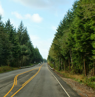
 About 30 miles south of Winchester Bay, this is what Hwy 101 looks like.  
 Cranberry bogs are frequent north and south of Coos Bay.  This one has been harvested and is ready for winter.
 Hwy 101 returns to parallel the ocean.  Even in the overcast conditions, it is beautiful.
 Now, how can you not love the southern coast of Oregon?
 Another face of Hwy 101.
 The marine layer combined with cloud overhead, makes the way look wonderfully mystical.
 The highway climbs to give different perspectives of the Pacific.  Because we've lived so long in this part of the world, we've become quite jaded.  We expect, some day, to take these views for granted, but it hasn't happened yet.
 Now we come back to sea level and know that we will soon have more close-ups of the water.
It looks like the rocks are gone.
 Wrong!
This rock captured our imagination.  The jagged edge doesn't look like it was created by erosion.  
 Ah, Gold Beach, OR lies across this bridge.  
 The art deco pillars mark the entrance to the bridge, it is a variation of the other Conde McCullough bridges along Hwy 101.
Looking down from the bridge, we saw lots of fishermen.

Brookings, OR in the rain.  There is a Fred Meyer grocery, Michael's, and a quilt shop that we couldn't find, even with GPS, many restaurants, and homes all over the hills.  There are three state parks.  Brookings is only 3 1/2 miles from the California border and is known to lie in the banana belt due to the mild winters in relationship to the rest of the Pacific Northwest coast.  We could have stayed longer.
The Pelican Bay Lighthouse is located in the private home of Bill Cady.  He received permission from the federal government to light it on July 4, 1999.  We could see this from our RV park.
If you want fancy, this isn't the place for you.  It is a parking lot, but what views!  
This is the view looking south from our RV.  Who needs fancy?  We can shut our blinds at night, listen to the roar of the breakers, and live in our luxury suite knowing that the next day, we have eye candy.
That is a surfer out our windshield.  To the right is the jetty.  We saw commercial fishing and pleasure vessels head out to sea from the harbor behind us.  We will be back.