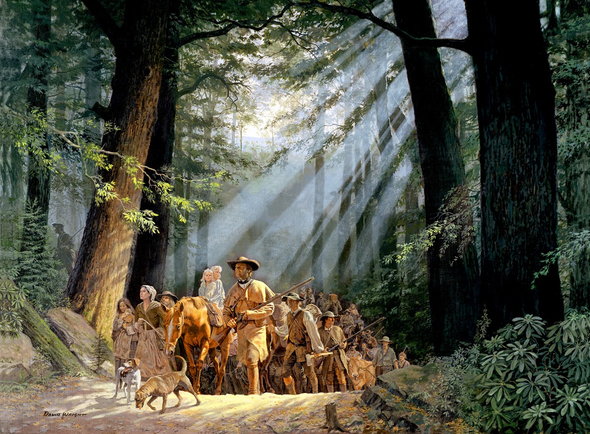
We've all most likely seen this David Wright painting, Gateway to the West, depicting Daniel Boone leading settlers through the Cumberland Gap. While this scene was quite unlikely, it does an excellent job of portraying how dark and forbidding the forest trails of the day must have been, and how courageous the early settlers were. As it turns out, one set of Penny's great-great-grandparents also made the trek.

The Cumberland Mountains formed an almost impenetrable barrier to those moving through this area. Looking down into The Gap from the Pinnacle Overlook, it is easy to see how important that passage was.

The Cumberland Gap was formed by a confluence of events. This photograph looks down into the Middleboro Crater, formed by the impact of a large meteor. At three miles in diameter, it was nowhere near the seventy-seven mile diameter of the meteor that formed the Chicxulub Crater, blamed for the extinction of the dinosaurs. Still, it dwarfs the Arizona meteor that formed the crater we showed in a earlier blog. That object has been calculated at less than one mile across. The other major factor forming the Gap was millennia of water erosion of the weakened rocks lining the Rocky Face Fault.

We took this, much easier, way to the Kentucky side from Tennessee so we could retrace the footsteps of Penny's ancestors.

Object lesson road was built over part of the original trail to convince officials and voters of the need for a better road through the Gap. It is a far smoother and clearer road than that which greeted settlers, but it still demonstrates the forbidding nature of travel in the late 18th century.

It travels into a dense mixed forest of oak, hickory, shortleaf pine, and eastern hemlock. It was beautiful and peaceful. There was no wind, so the major sounds were birdsong and our own footfalls.

The few clearings had a beauty and peacefulness of their own.

This photograph shows the steepness of some of the grades, no doubt steeper then. Imagine trying to come through here with a two-wheeled cart full of belongings, and children aged eleven months, two years and four years as Penny's ancestors did.

Part way into the ascent, we came across this trail. The Daughters of the American Revolution had Daniel Boone's original trail surveyed and marked. This was a portion of that trail. The boulder to the right was marked with a brass plaque commemorating the trail. Here, we joined the original Wilderness Road, over which the pioneers traveled.

At the apex of The Gap was this sign. At this point, we were in Virginia. We both smiled when we read the sign and felt a kind of kinship with those who had passed this way.

During the Civil War, both sides considered The Gap of considerable strategic importance. It changed hands more than once, but without bloodshed. Occupiers abandoned their positions several times due to difficulties of resupply and hard winters.

This is the Gap viewed from the Tennessee side. It's difficult to exaggerate the importance of this small geographic area, but we both felt a strong sense of history being here.
No comments:
Post a Comment